How is carbon measured? How to do projects in Plan Vivo
October 14, 2025
Carbon-rich ecosystems, such as forests, seagrass beds or mangrove swamps, are incredibly complex, with thousands of interactions between species. But how is carbon actually measured? This short article will guide you through the most important aspects - and what you should pay attention to.
How to measure carbon in nature - Plan Vivo
Many of the Plan Vivo climate projects that ZeroMission works with employ field technicians to measure how much carbon is stored in forests and planted trees. Measuring the diameter of the tree at breast height gives a good estimate of its overall size and the amount of carbon it stores. This method has been used by the forest industry and ecologists for decades.
Different tree species store different amounts of carbon. Slow-growing, dense trees store a lot of carbon per tree, while fast-growing species sequester carbon quickly. In addition, factors such as age, soil and climate also play a role. All of this is considered in the technical specifications when projects are developed.
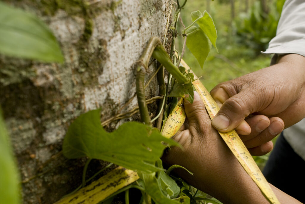
The circumference of a tree is measured in the Mexican project Scolel'te, certified by Plan Vivo. Find out more here.
Technologies within Plan Vivo to measure carbon data
Although manual measurements are well established, more and more technology is now being used to collect accurate carbon data. For example, our Plan Vivo Yaeda Valley in Tanzania uses satellite imagery to map baseline conditions - the technology allows us to track how the landscape has changed over time. Four sample years were analyzed, and images were taken from all months to capture the variations between dry and rainy seasons. The satellite system then classifies areas of 30 m² as forest or non-forest and makes a carbon assessment based on this. The results are then cross-checked by field technicians on the ground.
Another example is the developers behind Plan Vivo CommuniTree in Nicaragua, who have created their own technology platform - an app that facilitates the collection of tree data and combines digital technology with field visits.
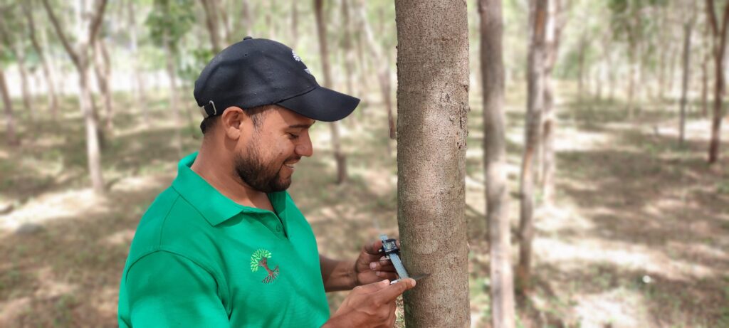
Technology is combined with field visits in the CommuniTree project in Nicaragua. Read more about the project certified by Plan Vivo here.
Is satellite imagery the best way to measure carbon sequestration?
Many studies have compared the strengths and weaknesses of different methods and concluded that although technology is improving, it still cannot replace the accuracy and experience of trained field technicians. This is why technology is used in combination with field visits.
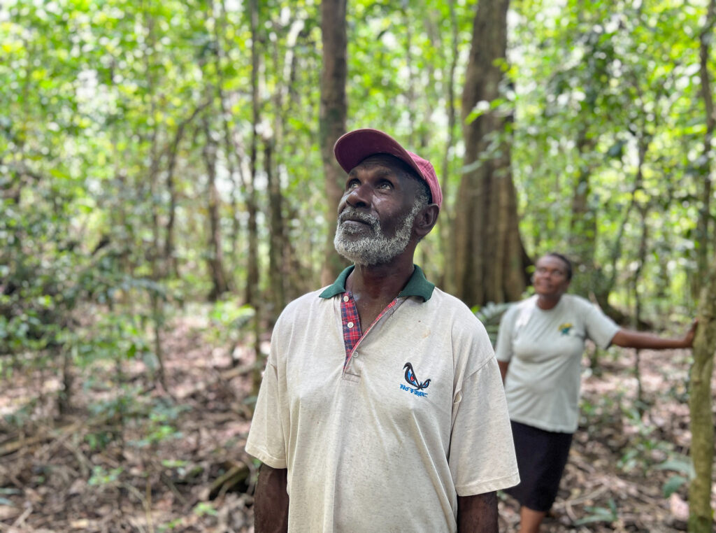
Our Plan Vivo certified project Drawa REDD+ in Fiji is a project that preserves rainforests. Find out more here.
Satellite imagery is excellent for determining whether an area is forested or not. Computer simulations do this by matching pixel colors and asking the question: "Is this shade of green likely to be tree canopy - or something else?" and then making a judgment. It's useful for seeing whether an area is being logged or regrowing, but when this data is used to estimate carbon sequestration, the margin of error becomes too large if it's not compared against field data. Many companies are working on improving software to make it more accurate and less dependent on comparability, but so far it cannot replace the skills of field technicians.
Furthermore, research by Wells et al (2017) shows that involving local communities in project monitoring increases both legitimacy and cost-effectiveness. The study also found that satellite monitoring was no more accurate than field measurements, and that if field visits are replaced by satellite monitoring, participants risk losing contact with the project and thus the possibility of support if needed.
Carbon credits from nature-based climate projects within Plan Vivo
Securing high-quality carbon credits from Plan Vivo's nature-based climate projects requires a careful balance between solid data collection, reliable verification and meaningful local engagement. Technology can support the process - but it cannot replace people, especially those who live and work closest to the ground.
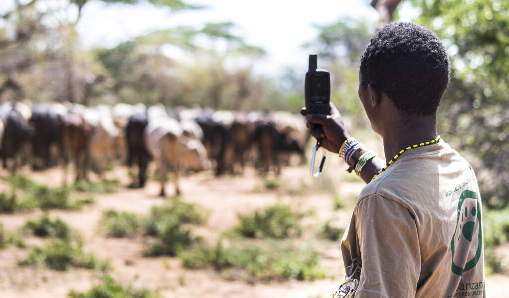
The Yaeda Valley project, certified by Plan Vivo, conserves forests in Tanzania in partnership with the Hadzabe indigenous people. Read more about the project here.
When reviewing a carbon credit, it is therefore worth asking not only where it comes from, but also how it has been measured, who has been involved and whether the systems behind it are designed for long-term and holistic impact.
Contact us to find out more about how you can support our Plan Vivo climate projects and take care of your climate impact.